URGENT ACTION NEEDED TODAY ON HIGHLIGHTED ARTICLES BELOW
Utah’s OHV community has experienced a temporary pause in new travel management planning due to the administrative transitions within the Department of the Interior (BLM) and Department of Agriculture (USFS). However, this pause is only temporary. Travel planning will resume in accordance with the 2017 Settlement Agreement—a process that continues to shape the future of motorized access across our public lands.
This update outlines what lies ahead, what challenges we face, and how every one of us can help protect access for all.
What is the 2017 Settlement Agreement?
The 2017 agreement—between BLM, SUWA, and BlueRibbon Coalition—mandated the reassessment or creation of 11 Travel Management Plans in Utah:
- Completed Plans: Henry Mountains & Fremont Gorge, San Rafael Desert, San Rafael Swell, Labyrinth/Gemini Bridges
- Upcoming or In Progress: Dinosaur North, Book Cliffs, 9 Mile Canyon, Indian Creek, Dolores River, Trail Canyon, Paunsaugunt
To date, over 2,000 miles of motorized routes—many of them offering dispersed camping, scenic access, and historic corridors—have been closed. These closures are being actively contested by groups such as BlueRibbon Coalition, Ride with Respect, Colorado Trail Preservation Alliance, Colorado OHV Coalition, and others. The State of Utah itself is involved in over 70 lawsuits challenging these restrictions, often citing RS 2477 rights-of-way and provisions of the Federal Land Policy and Management Act (FLPMA).
What’s Next?
Although BLM has temporarily marked some planning statuses as “Cancelled,” this is a bureaucratic reset. Work is only paused—pending direction from agency leadership and realignment of priorities. The next plans expected when restart begins will be:
- Trail Canyon
- Paunsaugunt
- Dolores River (which may gain 45 additional miles of designated routes)
- Dinosaur North
Throughout every NEPA phase, your route documentation—photos, narratives, and GPS logs—will be critical in defending these trails.
Why Are Roads Being Closed?
Travel management closures often stem from:
- Executive Order 11644 (signed in 1972 by President Nixon), which introduced the “minimization criteria” requiring agencies to limit OHV access to reduce environmental impacts. Unfortunately, agencies have adopted overly broad interpretations, often without adequate scientific or user input.
- “Natural reclamation” (a route appears unused due to overgrowth)
- BLM arbitrarily favors some forms of recreation over others.
- “Duplication” (parallel routes being labeled redundant despite offering different terrain, camping, or scenic value)
- Environmental concerns (wildlife habitat expansion or soil/watershed protection—often with minimal data)
- User conflicts, with noise complaints frequently cited but rarely substantiated
Will the Trump Administration Solve These Problems?
BlueRibbon Coalition has identified 26 harmful Executive Orders impacting access—four of which have already been rescinded, including reversals of the Biden Administration’s 30×30 agenda and the BLM Conservation Rule. While we anticipate further support under a Trump-led administration, legal and public pressure must continue from our side.
What Can You Do?
To turn the tide, we need every OHV enthusiast engaged. Here’s how:
- Start Using TrailSaver to Make Impactful Comments, especially on Kanab Area Trails in Pausaugant and Trail Canyon
Visit www.TrailSaver.com after each ride in Utah to document:
- Obstacles, campsites, viewpoints, historic or geologic features
- Photos and notes that demonstrate the value of these routes
When travel plans reopen, TrailSaver will send your notes and photos back to you—with a guide on how to turn your report into an effective public comment. Need help? Submit your draft to our Comments Coach, Rose, for personalized assistance in making your comment legally substantive.
- Help Us Change the Law
UPLA will support our work with BlueRibbon Coalition to create permanent protections for our access in Washington DC, which includes mobilizing grassroots support for key legislation, maintaining strong relationships with Congressional Members, and working with a professional lobbyist to expand our reach.
Please urge your lawmakers to support the following SEVEN access-focused bills and Actiions.
- Outdoor Americans with Disabilities Act (S.4215): Ensures motorized access for those using OHVs as mobility aids
- Western Economic Security Today (WEST) Act (H.R. 3397): Blocks “conservation leasing” that sidelines recreational use
- Ending Presidential Overreach on Public Lands Act (H.R. 5499): Requires Congressional and state input for national monument designations
- Historic Roadways Protection Act (H.R. 7635): Protects RS 2477 roads from federal closure
- Fix Our Forests Act (H.R. 7983): Streamlines forest management to reduce wildfire-related closures
- Green Tape Elimination Act (H.R. 6395): Speeds up trail and facility work by cutting redundant environmental reviews
- Joint Resolution to Overturn NPS Rule on Glen Canyon-Call your Senator’s today to urge them to Vote Yes on Joint Resolution 30 to overturn the rule prohibiting OHV access in Glen Canyon. THE SENATE IS VOTING ON THIS TOMORROW, MAY 7, SO PLEASE MAKE YOUR CALLS TODAY.
Make calls to your State Senator and Congressional Representative TODAY! Here’s a link to find your members of Congress.
- Donate to UPLA Now to Allow us to Double your Donation to BlueRibbon Coalition
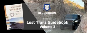
Join UPLA as a member and make a donation. Between now and May 31, UPLA will not only match your gift to BRC, but for every donation of at least $50 BlueRibbon will also mail you a free copy of Volume 3 of their Lost Trails Guidebook, which features 22 backcountry routes located within 10 proposed or recently designated National Monuments as a Thank You.
Final Word
Access to public lands isn’t guaranteed—it’s defended. Your voice, your photos, your outreach, and your dollars make a difference. Let’s ensure the roads we ride today remain open tomorrow.