How Bad Is the BLM Moab Decision?
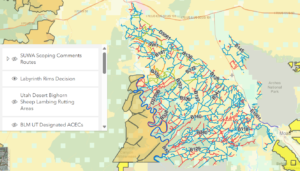
It’s very difficult to comprehend the extent of the adverse actions against OHV access to our public lands. This interactive ArcGIS map of the Labyrinth Rims Gemini Bridges is layered so you can compare the closed routes to lands with wilderness characteristics and bighorn sheep lambing habitat to see that’s where the vast majority of the closures are. There’s also a layer showing SUWA’s Red Rock Wilderness proposal which also includes the areas with the most closures.
This map is the courtesy of Patrick McKay with CO Offroad Trail Defenders Virtual Crew, who has done immense work in trying to protect our access.
Labyrinth Rims Decision (arcgis.com)
If you’re fed up, take action by donating to Utah Public Lands Alliance. Up to the first $50,000, every donation will be matched dollar for dollar and the entire amount given to BlueRibbon Coalition for supercharging our fight. That would big a war chest of $100,000 to get them started!
